Only by capturing the whole picture and understanding the nature and scale of the threats to ancient sites across this region can we build the tools and strategies to effectively preserve and protect this vital and vibrant part of our shared human heritage. Our methodology provides a safe and rapid method of collecting data across vast regions. By inputting this information into an online database to a uniform standard, it can be easily accessed from anywhere in the world by relevant authorities/heritage professionals. This will significantly improve how we monitor, analyse and manage this cultural heritage for future generations.

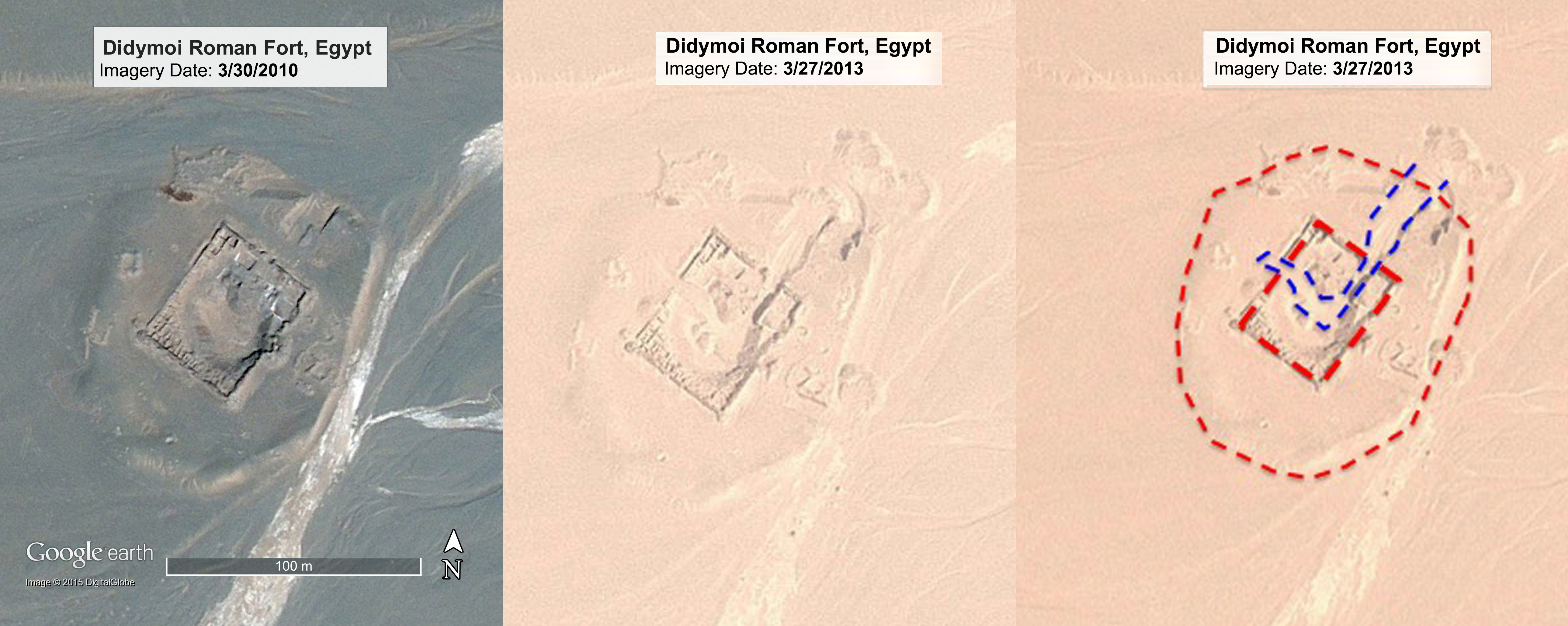
These three images of the 1st century AD Roman Didymoi Fort in the Eastern Desert of Egypt illustrate the power of analysing satellite images and comparing images over time. On the left an image of the fort captured in 2010; in the middle the same view captured three years later in 2013. In the right-hand image the EAMENA team has identified areas of significant destruction to the site, most likely caused by bulldozers. The red dashed line indicates the extent of the site and the damage is outlined in blue.
Interpreting satellite imagery enables archaeologists to search for ancient sites across large areas and in places where it is not safe to work on the ground or where access is severely restricted (e.g. Syria, Iraq, Libya and Yemen). Furthermore, aerial images reveal the ‘big picture’ of how sites interrelate and form complex social landscapes which transgress modern day boundaries and borders. From the macro to micro, with the development of high definition and high resolution imaging technologies, it is possible for trained specialists to distinguish ancient pits from modern looting holes; man-made spoil heaps from natural and geological forms.